August 31, 2013 – Saturday
Today we set the compass to “S” and drove down the coast for several planned stops. The first was Seal Rock and its beach. It was high tide, but the beach is very nice and with all the rocks should make a good tide pool without flies and a rocky beach to deal with. It warrants a return visit. A couple pictures follow.
Next stop was Waldport, mainly because of the Alsea Bridge. This is one of several bridges designed by Conde McCullough, Oregon’s state bridge engineer between 1919 and 1935. His design’s carry a Roman influence and are artistic as well as functional. His best known bridges are the five built along Highway 101 to span various waterways that required ferrying cars. Highway 101, the coastal highway, was built for military strategic use in the 1930-1940s, mainly as WPA projects, to move troops and equipment for protection of the coast before and during WWII. As usual, it got completed after WWII was over.
The Alsea Bay Bridge was rebuilt in the 1990s. They required that the new bridge carry McCullough’s design trademark. It was built along side the original utilizing concrete techniques not known in the 30s. The old one was then demolished. The following photo shows that new bridge.
Next stop was Yachats. This is a unique little town with really unusual houses. Their draw is a number of trails, many connected to the Oregon Coastal Trail. A couple of them were of interest to us. The first departs from Smelt Sands SP. This trail goes several miles up and down the coast along a rocky bluff above the ocean. It is a wide, smooth, and a pretty flat trail with bench and picnic tables scattered along the way. It goes right in front of beachfront homes and hotels, like close in front of. In Oregon, all the beaches are public including the land next to it. We’re not so sure it would be great having the public passing within 50 feet of our house.
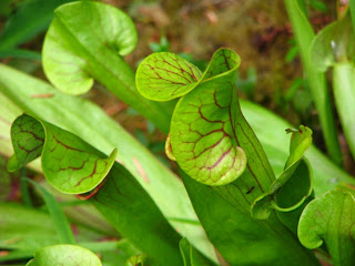
Another trail was in the Gerdemann Botanical Garden, which had a surprising collection of plants you would expect in the tropics, but not here. We then walked the Amanda Trail that has a statue of Amanda, a blind Coos Indian girl forced to walk along a rocky trail as the Indians got herded to reservations. Following is a picture.
The last stop for the day was Cape Perpetua. We took the Captain Cook Trail that leads to tide pools and to Spouting Horn, a rock out cropping that shoots up a column of water when a wave crashes in. It was low tide, +2.8 ft, so we went out to have a look at the tide pools. There wasn’t much to see as the tide was not low enough. At this place you needed to be Spiderman to negotiate the big rocks you had to climb over to get to the water. This place, like Cobble Beach, is a write off for tide pooling. Spouting Rock wasn’t spouting due to low tide and calm conditions.
It is now very foggy, damp, and cold; so we are heading back to base camp.


No comments:
Post a Comment