Saturday, August 31, 2013
Newport Area
August 29, 2013 – Thursday
It rained much of the night and yet this morning. Since the trip to South Beach is only about 75 miles we waited for the rain to let up before breaking camp. It finally did about 10AM. It was foggy and raining most of the way there, so we didn’t stop in Lincoln City as planned. Guess we’ll come back on a nicer day. Highway 101 is narrow in areas with some surprisingly steep hills. We got checked in at South Beach State Park a little after 1PM. Fortunately the rain let up, but was replaced by a strong cold wind.
After we dried off and warmed up, we headed over to the Hatfield Marine Center, run by Oregon State University. This place has some great kid’s educational exhibits including a “touch me” tide pool area. They also have exhibits on various marine research activities. A couple of interesting ones were obtaining energy from ocean waves and batteries using microbacteria from the ocean. There was a hunk of dock that floated over here from Japan’s tsunami. It took a year to get here and was covered with plant and animal species foreign to the waters on this coast. Fearing these could be disruptive to the coastal environment here, there are very strict rules if you find tsunami debris. Since Japan’s nuclear plant got wiped out there is some concern about radioactive debris as well.
August 30, 2013 – Friday
Overnight the wind died down, but it was very cloudy and foggy this morning, so we headed to the Oregon Coast Aquarium, which is less than 2 miles from the campground. The popular animals were the sea otters and seals. The otters were real hams and would come right up to the glass barrier to show off. They have an underwater fish tunnel, popular in most aquariums today.
The weather cleared and the sun came out. When we had seen pretty much everything at the aquarium, we headed for the two lighthouses nearby. The Yaquina Bay Lighthouse is the second oldest on the Oregon Coast, built in 1871. This lighthouse is build into the keeper’s quarters, making it unique since most are built separately. It has been faithfully restored and recently reactivated mainly for smaller fishing and recreational boats. A picture follows.
The second lighthouse, Yaquina Head Lighthouse, is still in operation, so we could only climb the 115 steps to the lantern room, the very top is USGC property. At the top it was possible to see the 2 inch tall 1000 watt bulb used to power it. Its first order Fresnel lens projects the beam 20 miles; pretty amazing. Back in the day, 1873, they used 4 wicks fueled with refined lard oil. The park includes an interpretive center and tide pools at Cobble Beach. It is a BLM run property, so we used our NPS pass to get in free.
Cobble Beach was rated a good tide pool area. Low tide today was 2:30 PM at +2.5 ft, so there wasn’t much to see as we were late by about an hour and half. However, there were two other big problems. First, the “beach” is a big pile of 2 to 4 inch cobble stone. Try walking up and down hills on this stuff, its terrible. Second is Oregon’s version of fish-flies. They are the size of house flies and swam all over you. Their life cycle is about a week. Fortunately they don’t bite, but land and cling. The scenery was pretty neat.
Last was a stop in Newport’s historic fishing village where the commercial fishermen boats are docked. This place was bustling with activity as boats off loaded fish and then loaded them into semi-trucks for processing. Mixed into all this were shops and restaurants. Neat place and close to the campground, so we may be back for a longer visit. A picture follows.
Wednesday, August 28, 2013
A Walk on the Beach
August 28, 2013 - Wednesday
It is foggy and cloudy today, but we wanted to do a little beach walking so we went back to Cape Lookout State Park. Low tide was around noon today so we arrived with a falling tide. The beach is not much different than we have already seen, but we went down toward one end that had some rocky outcroppings and got a glimpse of some interesting stuff. With fog, the area takes on a mystic appearance. Some pictures follow.
After a couple hours and a few miles of walking around we decided to go back to Cape Kiwanda. The fog had lifted a bit and we suspected there would also be less people than our visit on Sunday. We were right on both counts and as an added benefit, we saw some tide pools and a bunch of pelicans. Check out these pictures.
This is our last day in Tillamook. Tomorrow we head to South Beach State Park, just north of Newport, about 75 miles to the south of our current location. As before, the state parks do not have WiFi, so it may be a while before we will be doing a new post.
It is foggy and cloudy today, but we wanted to do a little beach walking so we went back to Cape Lookout State Park. Low tide was around noon today so we arrived with a falling tide. The beach is not much different than we have already seen, but we went down toward one end that had some rocky outcroppings and got a glimpse of some interesting stuff. With fog, the area takes on a mystic appearance. Some pictures follow.
After a couple hours and a few miles of walking around we decided to go back to Cape Kiwanda. The fog had lifted a bit and we suspected there would also be less people than our visit on Sunday. We were right on both counts and as an added benefit, we saw some tide pools and a bunch of pelicans. Check out these pictures.
This is our last day in Tillamook. Tomorrow we head to South Beach State Park, just north of Newport, about 75 miles to the south of our current location. As before, the state parks do not have WiFi, so it may be a while before we will be doing a new post.
Planes and Cheese
August 27, 2013 – Tuesday
Since it didn’t look like a very promising day to head to the beach, we sought some “out of the weather” activities. Dan’s idea was the Tillamook Air Museum, figures right? Lynn chose to forgo it and do laundry instead. So I will not be telling you about the laundry. Instead, you’ll hear about the interesting history of the blimp hangar at Air Station Tillamook. Although there are about 30 WWII vintage planes, the interesting thing is the museum.
The Tillamook Air Museum is located on the grounds of a decommissioned Naval Air Station, a blimp air station. Follow this link for more information.
.http://nastillamook.org/index.htm
Air ships were used to located submarines that were a threat to the coastal US waters and to commercial marine. Their slow speed and low altitude made them more effective than aircraft or patrol boats. They were filled with helium making them lighter than air (LTA) ships. The US Government then, as today, owns the world’s helium supply. It is a by-product of natural gas production. Helium for this and many facilities was railed in from Amarillo, TX and stored in underground tanks. The hangar has a compressor room and a big pipe that runs the length of the hangar.
This is one of two hangars originally built here, the other caught fire and burned down in the 90s. They were built in the forties to “dock” about a dozen air ships and were one of 17 such facilities. This hangar is huge, over 1000 feet long, 300 ft wide, 200 ft high. You can get an idea of its size in the following photo.
The amazing thing is they were all built of wood due to the shortage of steel at the time. There is sheet steel covering the outside. The thing leaks like crazy and the more valuable aircraft of the museum have a large plastic ceiling canopy to protect them. The Museum uses about ½ the hangar. The rest is to store RVs, boats, cars, and lumber.
The museum has a few interesting and rare pieces, but they are not presented well and in my opinion, the place looked like a dump. I hear they are looking for a very needed new location.
Great timing, when I got back the laundry was done. Hey, men have a sixth sense for that stuff! To make up, I told Lynn I’d get her an ice cream at Tillamook Creamery, so that’s the next stop. Of course it isn’t the ice cream they are known for; it’s the cheese. Cheddar is their specialty. Some is aged up to 17 years for the extra sharp. Although the tour was self guided, we did learn about how cheese is made. It’s all mechanized, automated, and processor controlled now. No little old bearded guy that looks like a monk with a canoe paddle doing it. The Creamery is an association of 30 or so farmers in the area that sell their milk.
Cheese and ice cream are about their only products. They also make yogurt and butter, but elsewhere. The cheese product line came about because it is relatively easy to ship longer distances compared to milk; it doesn’t spoil. In stores around here it runs about 10-15% higher in price. Lots of yummy samples. Their ice cream is pretty good, but not as good as the old original Saunders brand, for those that remember that.
Hopefully tomorrow, weather permitting, we'll get to do some beach walking
Since it didn’t look like a very promising day to head to the beach, we sought some “out of the weather” activities. Dan’s idea was the Tillamook Air Museum, figures right? Lynn chose to forgo it and do laundry instead. So I will not be telling you about the laundry. Instead, you’ll hear about the interesting history of the blimp hangar at Air Station Tillamook. Although there are about 30 WWII vintage planes, the interesting thing is the museum.
The Tillamook Air Museum is located on the grounds of a decommissioned Naval Air Station, a blimp air station. Follow this link for more information.
.http://nastillamook.org/index.htm
Air ships were used to located submarines that were a threat to the coastal US waters and to commercial marine. Their slow speed and low altitude made them more effective than aircraft or patrol boats. They were filled with helium making them lighter than air (LTA) ships. The US Government then, as today, owns the world’s helium supply. It is a by-product of natural gas production. Helium for this and many facilities was railed in from Amarillo, TX and stored in underground tanks. The hangar has a compressor room and a big pipe that runs the length of the hangar.
This is one of two hangars originally built here, the other caught fire and burned down in the 90s. They were built in the forties to “dock” about a dozen air ships and were one of 17 such facilities. This hangar is huge, over 1000 feet long, 300 ft wide, 200 ft high. You can get an idea of its size in the following photo.
The amazing thing is they were all built of wood due to the shortage of steel at the time. There is sheet steel covering the outside. The thing leaks like crazy and the more valuable aircraft of the museum have a large plastic ceiling canopy to protect them. The Museum uses about ½ the hangar. The rest is to store RVs, boats, cars, and lumber.
The museum has a few interesting and rare pieces, but they are not presented well and in my opinion, the place looked like a dump. I hear they are looking for a very needed new location.
Great timing, when I got back the laundry was done. Hey, men have a sixth sense for that stuff! To make up, I told Lynn I’d get her an ice cream at Tillamook Creamery, so that’s the next stop. Of course it isn’t the ice cream they are known for; it’s the cheese. Cheddar is their specialty. Some is aged up to 17 years for the extra sharp. Although the tour was self guided, we did learn about how cheese is made. It’s all mechanized, automated, and processor controlled now. No little old bearded guy that looks like a monk with a canoe paddle doing it. The Creamery is an association of 30 or so farmers in the area that sell their milk.
Cheese and ice cream are about their only products. They also make yogurt and butter, but elsewhere. The cheese product line came about because it is relatively easy to ship longer distances compared to milk; it doesn’t spoil. In stores around here it runs about 10-15% higher in price. Lots of yummy samples. Their ice cream is pretty good, but not as good as the old original Saunders brand, for those that remember that.
Hopefully tomorrow, weather permitting, we'll get to do some beach walking
Monday, August 26, 2013
The Forest for the Trees
August 26, 2013 – Monday
It’s raining like crazy now, but when we got up this morning the sun was shining and it was nice, so we headed to Munson Falls located on the outskirts of Tillamook. This is the highest falls in the Oregon Coastal area, over 266 feet high. It was a short hike off the road south of town. They are quite pretty, although not a huge volume of water. The trail there really gave us the rain forest effect. It made you think of Sherwood Forest and Robin Hood. The trees had lichen growing all over them giving them a furry appearance. Some pictures follow.
We then travelled east to the Tillamook Forest Center, an interesting center for learning how Oregon is managing the Tillamook State Forest. They had major forest fires here in 1933, 1946, and 1951 that devastated much of the forest in the Tillamook area. It told how they lumbered out the burned snags and replanted with Douglas Firs. Today little remains of that devastation. Their management of the situation set the standard for how forests are restored and managed. The center had a bunch of trails and a fire lookout station replica. These fire lookouts were managed 24 hours a day usually by 2 people on shifts. They are stuck in these things for several days until rotated out. A lonely job to be sure.
It’s raining like crazy now, but when we got up this morning the sun was shining and it was nice, so we headed to Munson Falls located on the outskirts of Tillamook. This is the highest falls in the Oregon Coastal area, over 266 feet high. It was a short hike off the road south of town. They are quite pretty, although not a huge volume of water. The trail there really gave us the rain forest effect. It made you think of Sherwood Forest and Robin Hood. The trees had lichen growing all over them giving them a furry appearance. Some pictures follow.
We then travelled east to the Tillamook Forest Center, an interesting center for learning how Oregon is managing the Tillamook State Forest. They had major forest fires here in 1933, 1946, and 1951 that devastated much of the forest in the Tillamook area. It told how they lumbered out the burned snags and replanted with Douglas Firs. Today little remains of that devastation. Their management of the situation set the standard for how forests are restored and managed. The center had a bunch of trails and a fire lookout station replica. These fire lookouts were managed 24 hours a day usually by 2 people on shifts. They are stuck in these things for several days until rotated out. A lonely job to be sure.
Coastal Adventure Part 2
August 23, 2013 – Friday
Today is a travel day. We are leaving Ft. Stevens SP to get to Bay City, a northern “suburb” of Tillamook, about 60 miles away. The weather is dismal, very foggy, and misty. The tow was okay, though 101 is a bit narrow and twisty. There was pretty dense fog, making it even more interesting in parts. We got to Tillamook – Bay City about 2PM. After setting up, it was off for groceries.
August 24, 2013 – Saturday
With the weather clearing up, we thought we would run the Three Capes scenic route. The first stop was in Oceanside to walk the beach at low tide. Although pretty, it did not have the tide pools and critters that Indian Beach had.
The next stop was the Cape Meares Lighthouse. This lighthouse is a bit unique for a number of reasons; first it is the shortest at 38 feet tall, but sits on a pretty high bluff so it is over 200 feet above the ocean. Second is the lens, a first order, 8 sided Fresnel lens which provided visibility out 21 miles. Finally, it alternates red and white. About 3 years ago they had a vandalism incident where a couple of local guys shot at it and did $100,000 in damage.
Finally today, we went back up to Cannon Beach at Tolovana Wayside and walked over to Haystack rock. The weather has improved all day, it is beautiful. As you can see from the picture, this is a popular beach.
August 25, 2013 – Sunday
It was quite foggy this morning but decided to complete our Three Capes tour. The second Cape was Cape Lookout, requiring a 2 ½ mile hike to get there. Since it was very soupy we passed and moved onto Cape Kiwanda. It is near Pacific City. The landscape is really different here, lots of sand and dunes. The reason we came here was to watch fisherman launch and retrieve their boats on the beach. We got here too late to watch anybody launch, but did see several retrievals. The process is pretty unique; they come in to the beach at high speed, then kill and tilt the motor at the last second. The boat slides up onto the beach a hundred feet or so. They then back the tilt trailer under the boat and winch it home.
http://www.youtube.com/watch?v=xHqUfaI1qf8&feature=youtu.be
Pretty entertaining!
After a nice walk on the beach, we headed back up to Rockaway Beach, then Garibaldi. The latter is pretty interesting with its old trains, fishing port, and logging. We bought a cool wood piece made of Myrtlewood for our wall. Myrtlewood is a very hard wood and unique to the Northwest.
Not sure on tomorrow’s agenda, as it is supposed to rain for next 24 hours.
Today is a travel day. We are leaving Ft. Stevens SP to get to Bay City, a northern “suburb” of Tillamook, about 60 miles away. The weather is dismal, very foggy, and misty. The tow was okay, though 101 is a bit narrow and twisty. There was pretty dense fog, making it even more interesting in parts. We got to Tillamook – Bay City about 2PM. After setting up, it was off for groceries.
August 24, 2013 – Saturday
With the weather clearing up, we thought we would run the Three Capes scenic route. The first stop was in Oceanside to walk the beach at low tide. Although pretty, it did not have the tide pools and critters that Indian Beach had.
The next stop was the Cape Meares Lighthouse. This lighthouse is a bit unique for a number of reasons; first it is the shortest at 38 feet tall, but sits on a pretty high bluff so it is over 200 feet above the ocean. Second is the lens, a first order, 8 sided Fresnel lens which provided visibility out 21 miles. Finally, it alternates red and white. About 3 years ago they had a vandalism incident where a couple of local guys shot at it and did $100,000 in damage.
Finally today, we went back up to Cannon Beach at Tolovana Wayside and walked over to Haystack rock. The weather has improved all day, it is beautiful. As you can see from the picture, this is a popular beach.
August 25, 2013 – Sunday
It was quite foggy this morning but decided to complete our Three Capes tour. The second Cape was Cape Lookout, requiring a 2 ½ mile hike to get there. Since it was very soupy we passed and moved onto Cape Kiwanda. It is near Pacific City. The landscape is really different here, lots of sand and dunes. The reason we came here was to watch fisherman launch and retrieve their boats on the beach. We got here too late to watch anybody launch, but did see several retrievals. The process is pretty unique; they come in to the beach at high speed, then kill and tilt the motor at the last second. The boat slides up onto the beach a hundred feet or so. They then back the tilt trailer under the boat and winch it home.
http://www.youtube.com/watch?v=xHqUfaI1qf8&feature=youtu.be
Pretty entertaining!
After a nice walk on the beach, we headed back up to Rockaway Beach, then Garibaldi. The latter is pretty interesting with its old trains, fishing port, and logging. We bought a cool wood piece made of Myrtlewood for our wall. Myrtlewood is a very hard wood and unique to the Northwest.
Not sure on tomorrow’s agenda, as it is supposed to rain for next 24 hours.
Friday, August 23, 2013
Coastal Adventure Part 1
August 19, 2013 – Monday
Our route to Fort Stevens State Park, our current location, was interesting. Instead of trekking here via interstates, we opted to use State Highway 30 and 30 by-pass. This route passes north of Portland through several small towns. The going was slow, but afforded views of the Columbia and the little towns were unique. There was a section of 30 with some pretty big hills, like 5-6% grades. It is cloudy, cool, and somewhat breezy, so after getting settled in, we decided to explore the old fort, from which the park derives its name.
The fort was established in 1862 for defense of Confederates during the Civil War. Ironically, it was completed one day before the end of the war. It was modified for continued use until after WWII. With all the modifications and the fact that most buildings are gone, makes it hard to visualize it as more than a ruin. Compared to Michigan forts in State Parks, this one is a loser. One interesting event was that the fort was fired on by a Japanese submarine in WWII. It was outside the fort’s gun range for them to answer fire. No damage was sustained and the sub left after firing 17 rounds. A couple pictures follow.
August 20, 2013 – Tuesday
On the agenda today are visits to the Maritime Museum and Column in Astoria. This area is interesting due to the confluence of the Columbia River and Pacific Ocean. There is a huge flow of water out the river which slams into 8 foot tides coming in off the ocean. Couple that with big winds and storms off the Pacific and it is easy to see the navigation challenges it presents. This mixer action creates shoaling at the entrance to the river. In its history, over 2000 shipwrecks have occurred as a result of grounding, with hundreds of seamen killed. Aids to navigation helped a little but the channel shifts around so much that it is still a problem in storms.
In the 1920s time frame, two jetties were constructed which narrowed the river; increasing the flow and blocking sand from building up in the river entrance. The Maritime Museum explains a bunch of this as well as the shipping along the Columbia in the form of steam powered stern and side wheelers. There was quite a bit about sea rescue and the Coast Guard role. The USCG developed a self righting rescue boat for this area. They also conduct rescue training here, figuring if you can make the muster here, you can do it anywhere. Also moored here is the decommissioned Lightship Columbia that used to be moored about six miles out from the river mouth. A couple of pictures from the museum follow.
The second stop was the Astoria Column. This is a historical maker with murals engraved along its 125 feet of height. There are 22 murals depicting events that shaped this area over the past 300 years. It is one of 12 such structures across the US. They did not indicate where they all are. 164 steps take you up to the top. Astoria is the oldest town in western US. Some pictures of the column and views from the top follow.
After dinner we decided to see the wreck of the Peter Iredale, only visible at low tide. This big 3 masted sailing ship beached here in 1906, and has been rotting away every since. Check out the following picture!
August 21, 2013 – Wednesday
Our objective here is to see the Columbia Bar, no not for a beer, the sand bar that gives this place its notoriety. We were told you need to go across the river to Cape Disappointment, so that is our destination. The area is a Washington State Park, with two lighthouses, a Lewis and Clark interpretive center, and the opportunity to see the “Bar”. First to view was the North Head Lighthouse, picture follows. There was a bonus here. On our way to the lighthouse we observed the USCG running rescue exercises from their helicopter. Check out the pix.
We then went through the L&C center, which had great written details, along with pictures and paintings that depicted Lewis and Clark’s journey from St. Louis to the mouth of the Columbia. Thabout a ½ mile to the Cape Disappointment LH. It is still operational, complete with a Guardsman on duty there. is put together all the bits and pieces of what we had previously learned. From here we hiked
Our last stop was a walk out on the North Jetty for a close up of the bar. It was an ebbing tide, but there were breakers coming over it. It was easy to see why navigating this thing is such a challenge. Only a relatively narrow channel winds through here. It requires a local pilot to get ocean freighters through it. The NW winds whistling through this area are remarkable. As we walked the jetty your legs were getting sandblasted. Along Benson Beach the sand has piled up on the jetty filling all the voids between the rocks and blowing over it. Check out the picture.
August 22, 2013 – Thursday
Today it was off to the beach, Indian Beach in the Ecola State Park. We planned to be there at low tide, about 8AM. Being 50 miles away it was an early start to the day and wow, it was worth it! This place was like nothing we have seen before. There were huge rocks and out-croppings with scads of marine critters hanging on them. Star fish, sea anemones, oysters, crabs, clams, and other things you normally see underwater. It was foggy when we got there, then cleared a bit, then got foggy again as the tide came it. This was the tricky part. We were in a rising tide situation, walking a beach with virtually no shoreline, only big rocks. The tide is 8 feet, so it was very important to make sure we made it back to the access area before the tide got too deep. As it was we had to wade through some areas that we had walked through earlier. Check out the pictures!
We continued our drive down the coast but it was really too foggy to see much, so we decided to explore via hikes at Oswald West State Park. Very nice trails in this park. To our surprise they had a rest room right in the center of several trails. Not an outhouse, real restrooms with running water! One of the trails took us over to Short Sand Beach where some folks were surfing and someone offered to take our picture.

Our route to Fort Stevens State Park, our current location, was interesting. Instead of trekking here via interstates, we opted to use State Highway 30 and 30 by-pass. This route passes north of Portland through several small towns. The going was slow, but afforded views of the Columbia and the little towns were unique. There was a section of 30 with some pretty big hills, like 5-6% grades. It is cloudy, cool, and somewhat breezy, so after getting settled in, we decided to explore the old fort, from which the park derives its name.
The fort was established in 1862 for defense of Confederates during the Civil War. Ironically, it was completed one day before the end of the war. It was modified for continued use until after WWII. With all the modifications and the fact that most buildings are gone, makes it hard to visualize it as more than a ruin. Compared to Michigan forts in State Parks, this one is a loser. One interesting event was that the fort was fired on by a Japanese submarine in WWII. It was outside the fort’s gun range for them to answer fire. No damage was sustained and the sub left after firing 17 rounds. A couple pictures follow.
August 20, 2013 – Tuesday
On the agenda today are visits to the Maritime Museum and Column in Astoria. This area is interesting due to the confluence of the Columbia River and Pacific Ocean. There is a huge flow of water out the river which slams into 8 foot tides coming in off the ocean. Couple that with big winds and storms off the Pacific and it is easy to see the navigation challenges it presents. This mixer action creates shoaling at the entrance to the river. In its history, over 2000 shipwrecks have occurred as a result of grounding, with hundreds of seamen killed. Aids to navigation helped a little but the channel shifts around so much that it is still a problem in storms.
In the 1920s time frame, two jetties were constructed which narrowed the river; increasing the flow and blocking sand from building up in the river entrance. The Maritime Museum explains a bunch of this as well as the shipping along the Columbia in the form of steam powered stern and side wheelers. There was quite a bit about sea rescue and the Coast Guard role. The USCG developed a self righting rescue boat for this area. They also conduct rescue training here, figuring if you can make the muster here, you can do it anywhere. Also moored here is the decommissioned Lightship Columbia that used to be moored about six miles out from the river mouth. A couple of pictures from the museum follow.
The second stop was the Astoria Column. This is a historical maker with murals engraved along its 125 feet of height. There are 22 murals depicting events that shaped this area over the past 300 years. It is one of 12 such structures across the US. They did not indicate where they all are. 164 steps take you up to the top. Astoria is the oldest town in western US. Some pictures of the column and views from the top follow.
After dinner we decided to see the wreck of the Peter Iredale, only visible at low tide. This big 3 masted sailing ship beached here in 1906, and has been rotting away every since. Check out the following picture!
August 21, 2013 – Wednesday
Our objective here is to see the Columbia Bar, no not for a beer, the sand bar that gives this place its notoriety. We were told you need to go across the river to Cape Disappointment, so that is our destination. The area is a Washington State Park, with two lighthouses, a Lewis and Clark interpretive center, and the opportunity to see the “Bar”. First to view was the North Head Lighthouse, picture follows. There was a bonus here. On our way to the lighthouse we observed the USCG running rescue exercises from their helicopter. Check out the pix.
We then went through the L&C center, which had great written details, along with pictures and paintings that depicted Lewis and Clark’s journey from St. Louis to the mouth of the Columbia. Thabout a ½ mile to the Cape Disappointment LH. It is still operational, complete with a Guardsman on duty there. is put together all the bits and pieces of what we had previously learned. From here we hiked
Our last stop was a walk out on the North Jetty for a close up of the bar. It was an ebbing tide, but there were breakers coming over it. It was easy to see why navigating this thing is such a challenge. Only a relatively narrow channel winds through here. It requires a local pilot to get ocean freighters through it. The NW winds whistling through this area are remarkable. As we walked the jetty your legs were getting sandblasted. Along Benson Beach the sand has piled up on the jetty filling all the voids between the rocks and blowing over it. Check out the picture.
August 22, 2013 – Thursday
Today it was off to the beach, Indian Beach in the Ecola State Park. We planned to be there at low tide, about 8AM. Being 50 miles away it was an early start to the day and wow, it was worth it! This place was like nothing we have seen before. There were huge rocks and out-croppings with scads of marine critters hanging on them. Star fish, sea anemones, oysters, crabs, clams, and other things you normally see underwater. It was foggy when we got there, then cleared a bit, then got foggy again as the tide came it. This was the tricky part. We were in a rising tide situation, walking a beach with virtually no shoreline, only big rocks. The tide is 8 feet, so it was very important to make sure we made it back to the access area before the tide got too deep. As it was we had to wade through some areas that we had walked through earlier. Check out the pictures!
We continued our drive down the coast but it was really too foggy to see much, so we decided to explore via hikes at Oswald West State Park. Very nice trails in this park. To our surprise they had a rest room right in the center of several trails. Not an outhouse, real restrooms with running water! One of the trails took us over to Short Sand Beach where some folks were surfing and someone offered to take our picture.

Sunday, August 18, 2013
Columbia River Gorge - Road Trips
August 16, 2013 – Friday
We took a road trip today to some interesting places toward the eastern end of the Gorge. Our destination was Hood River about 40 miles east of Troutdale. The objective was the Western Antique Aeroplane and Automobile Museum (WAAAM). I know what you’re thinking, another Dan place. Well, you’d be right. I’m fortunate that Lynn puts up with this. This museum had a huge collection of mostly early 1900s aircraft and cars from the late 1800s to mid 1900s. It is located on airport grounds in Hood River and almost everything in there works and is taken out on occasion and flown or driven. So these are not just restored; they are functional. The place was a little dim in light so did not get many usable pictures, but a couple follow.
We then turned south into the country, what they call the “Fruit Loop”. So named for all the roadside markets selling fresh fruit. We stopped to buy some peaches, pears, and cherries. They were yummy. It is amazing the difference in taste of truly ripe and fresh fruit. Upon recommendation, our next stop took us to Timberline Lodge. This place sits about halfway up Mt. Hood. It was built in the 30s as a WPA project for skiers. It has been restored and is like stepping back in time. A couple of pictures follow.
August 17, 2013 – Saturday
Another road trip; today to The Dalles. The correct pronunciation is like “the-dells” but with an “a”. The name came from the French La Dalles meaning narrows and falls. There is a large dam there, bigger than Bonneville. We learned there were 10 miles of falls in this area that required portage of goods. The Celilo Falls were used by the Indians to catch Salmon and this dam covered them up, which did not and still does not sit well with them.
In the early 1800s a fort was built in the area called Fort Dalles. It was intended as an in-between for Fort Vancouver and Fort Laramie to keep an eye on Indian threats and for people coming into the area via the Oregon Trail. It saw little or no action and was abandoned when the Civil War broke out. The only building left was the Surgeon’s Quarters. The others burnt down. This remaining building houses a museum along with a homestead moved to provide history related to the way of life in this area. Somewhat disappointing was the fact that all the stuff related to the fort were taken when the soldiers left. The rooms contain artifacts from around The Dalles during the period.
What made this place special was the docent who has lived in this area her entire life. She brought an interesting perspective and lived during completion of the dam and its impact on the people here. She was also very knowledgeable of the families and way of life in the early years in the area. We figured an hour tops, instead we spent several hours!
The last stop was to St Peter’s Church, actually now a landmark as a new church was built. There we also had an extended conversation with the docent. In both locations, we were the only folks visiting. It was great! A picture follows.
Following are some picture looking down on The Dalles from an outlook above the town. Also a pretty cool view of Mt Adams.
We made a quick stop on the way home at the outlook over the Gorge not far from the campground. It will likely be the last picture of the Gorge.
August 18, 2013 - Sunday
We have some grocery shopping to do and there is a car show in town, so guess where we're going? Today is our last day here, then we head to the Coast and Ft Steven State Park in Hammond, OR. We will not likely have WiFi for a while so this may be our last post for a few days. It has been interesting, but truthfully, there are places we've been that are prettier from a scenic standpoint. We hope you are having as much fun following as we are doing it!
We took a road trip today to some interesting places toward the eastern end of the Gorge. Our destination was Hood River about 40 miles east of Troutdale. The objective was the Western Antique Aeroplane and Automobile Museum (WAAAM). I know what you’re thinking, another Dan place. Well, you’d be right. I’m fortunate that Lynn puts up with this. This museum had a huge collection of mostly early 1900s aircraft and cars from the late 1800s to mid 1900s. It is located on airport grounds in Hood River and almost everything in there works and is taken out on occasion and flown or driven. So these are not just restored; they are functional. The place was a little dim in light so did not get many usable pictures, but a couple follow.
We then turned south into the country, what they call the “Fruit Loop”. So named for all the roadside markets selling fresh fruit. We stopped to buy some peaches, pears, and cherries. They were yummy. It is amazing the difference in taste of truly ripe and fresh fruit. Upon recommendation, our next stop took us to Timberline Lodge. This place sits about halfway up Mt. Hood. It was built in the 30s as a WPA project for skiers. It has been restored and is like stepping back in time. A couple of pictures follow.
August 17, 2013 – Saturday
Another road trip; today to The Dalles. The correct pronunciation is like “the-dells” but with an “a”. The name came from the French La Dalles meaning narrows and falls. There is a large dam there, bigger than Bonneville. We learned there were 10 miles of falls in this area that required portage of goods. The Celilo Falls were used by the Indians to catch Salmon and this dam covered them up, which did not and still does not sit well with them.
In the early 1800s a fort was built in the area called Fort Dalles. It was intended as an in-between for Fort Vancouver and Fort Laramie to keep an eye on Indian threats and for people coming into the area via the Oregon Trail. It saw little or no action and was abandoned when the Civil War broke out. The only building left was the Surgeon’s Quarters. The others burnt down. This remaining building houses a museum along with a homestead moved to provide history related to the way of life in this area. Somewhat disappointing was the fact that all the stuff related to the fort were taken when the soldiers left. The rooms contain artifacts from around The Dalles during the period.
What made this place special was the docent who has lived in this area her entire life. She brought an interesting perspective and lived during completion of the dam and its impact on the people here. She was also very knowledgeable of the families and way of life in the early years in the area. We figured an hour tops, instead we spent several hours!
The last stop was to St Peter’s Church, actually now a landmark as a new church was built. There we also had an extended conversation with the docent. In both locations, we were the only folks visiting. It was great! A picture follows.
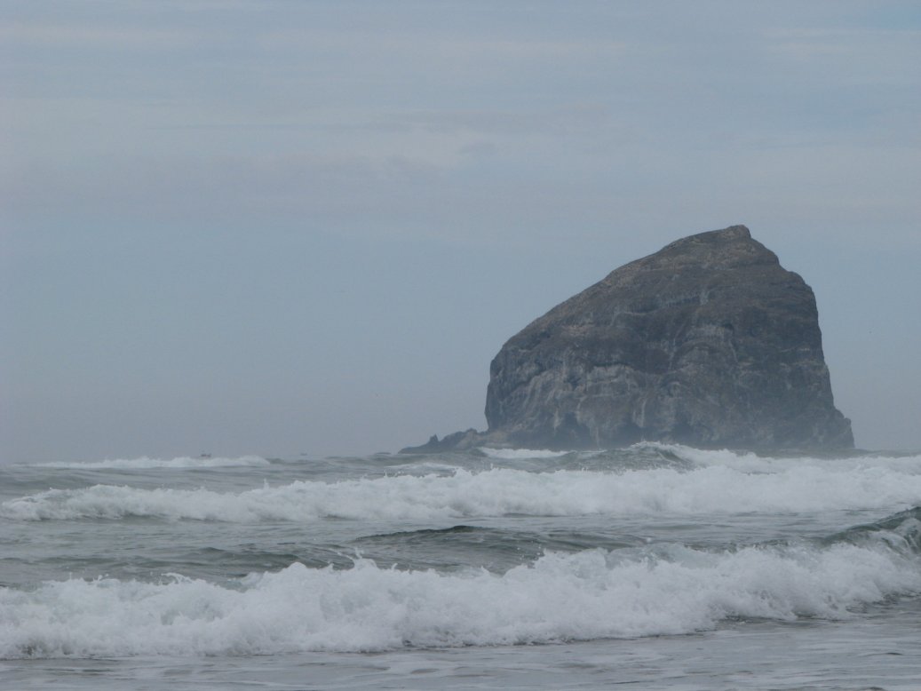
Following are some picture looking down on The Dalles from an outlook above the town. Also a pretty cool view of Mt Adams.
We made a quick stop on the way home at the outlook over the Gorge not far from the campground. It will likely be the last picture of the Gorge.
August 18, 2013 - Sunday
We have some grocery shopping to do and there is a car show in town, so guess where we're going? Today is our last day here, then we head to the Coast and Ft Steven State Park in Hammond, OR. We will not likely have WiFi for a while so this may be our last post for a few days. It has been interesting, but truthfully, there are places we've been that are prettier from a scenic standpoint. We hope you are having as much fun following as we are doing it!
Subscribe to:
Posts (Atom)


